
TheDigger.gold: a new application designed for field researchers
Gold prospecting is facilitated by a free application that aims to be an indispensable tool for gold researchers!
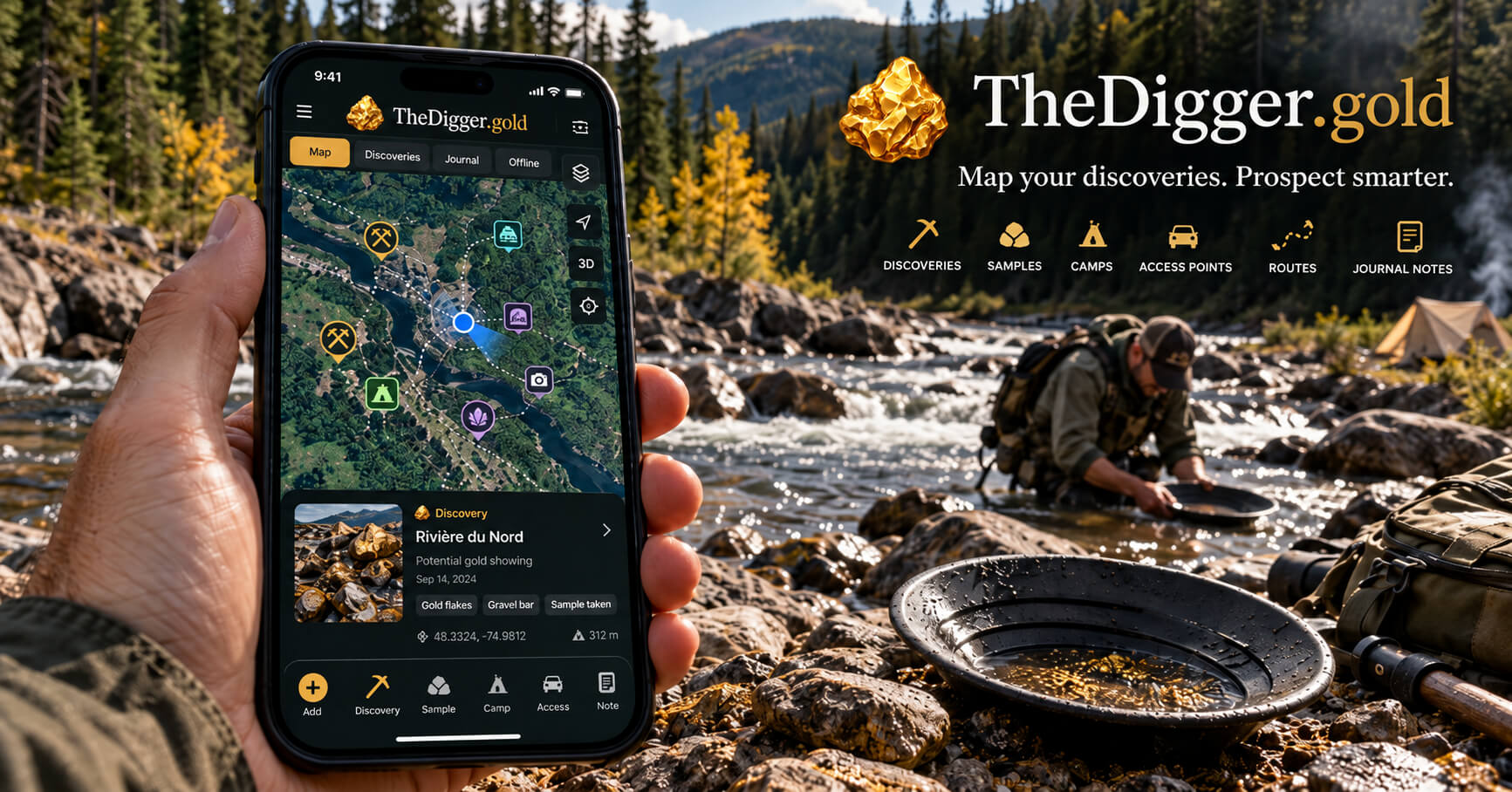
Gold prospecting is still often based on a mixture of paper maps, quick notes, photos scattered over a telephone and GPS coordinates stored in various tools.
TheDigger.gold was designed to bring these elements together in a single application specifically designed for the research community, both during the preparation of an output and directly on the ground.
The objective is simple: to allow a prospector to better organize his research areas, his discoveries, his samplings, his accesses, his camps and his observations, while maintaining precise control over the confidentiality of his information.
A cartography thought for gold exploration
At the heart of TheDigger.gold is an interactive mapping system.
Users can create different cards according to their needs:
- a river;
- a forest sector;
- a concession;
- a prospecting area;
- a territory explored with a team.
On each of these maps, it is possible to add different types of points of interest, represented by markers adapted to the context of prospecting:
- Discovered
- Sampling
- Access
- Camping
- Other point of interest
Each point is associated with accurate GPS coordinates and may contain notes and photographs.
These photos appear as miniatures and can be expanded when you look at the point of interest.
The idea is to allow the prospector to quickly find what he has observed in the field without having to look in several different applications.
Prepare an exit before leaving
TheDigger.gold is not only intended for use when returned to the riverside.
The application can also be used to prepare a shipment.
Before leaving, the researcher can:
- create a work card;
- identify the sectors he wishes to explore;
- identifying potential access;
- determine where to establish a camp;
- prepare his routes.
Advanced mapping also allows working with different map backgrounds, including classic topographic, satellite or cartographic representations depending on the availability of suppliers.
It is also possible to map routes and prospecting areas, which facilitates the planning of areas to be inspected or the tracking of previously explored portions.
The import and export of geographical data also allow us to work with formats such as GeoJSON and GPX for certain tracks.
A mobile app designed for the field
One of the important objectives of TheDigger.gold is to be able to be used directly from a mobile phone.
When in the field, the prospector can use the geolocation of his device to display his position on the map and quickly create a new point of interest from his current coordinates.
An interesting discovery can be documented immediately.
For example, a user can:
- locate its position;
- record a point Discovered;
- add one or more photos;
- record comments;
- maintain GPS coordinates;
- find this point later on the map.
The same logic applies to sampling, access roads, camps or other useful information.
An integrated prospecting journal
TheDigger.gold also includes a prospecting journal.
Each output can be documented with:
- its date;
- its duration;
- the conditions encountered;
- observations made.
An exit can then be associated with the different GPS points recorded during this day.
This approach allows for the gradual construction of a true prospecting history.
After several outputs in the same area, the user can find not only his GPS points, but also the context in which they were observed.
This function becomes particularly interesting when you want to compare different periods, different water levels or different sampling areas.
Photos directly associated with discoveries
Photographs often play an important role in prospecting.
This may include:
- a rock formation;
- a sample;
- a portion of a river;
- access;
- a visual marker.
TheDigger.gold allows to associate several photos with a point of interest.
These images remain linked to the corresponding GPS point and can be viewed directly from the map.
The user no longer needs to browse the full gallery of his phone to find a photo taken several weeks earlier.
Working alone or as a team
Prospecting can be an individual activity, but it can also be done in a group.
TheDigger.gold allows to create teams of prospectors and manage the members involved.
The cards can be:
- personal;
- associated with a team.
Role and permission systems help determine who can view or modify certain information.
A prospector can therefore retain certain strictly private points while sharing other observations with its partners.
The application also includes comments on points of interest and a system of notifications to track certain collaborative activities.
Confidentiality of sites remains important
In the field of prospecting, some coordinates can be of great value.
TheDigger.gold was therefore developed taking this reality into account.
One point may remain private and may not be visible to other team members.
Access controls are applied to:
- maps; GPS points;
- photographs;
- associated data.
Even administrative functions have been designed so as not to automatically give access to private user coordinates.
A partial offline operation
Gold researchers regularly work in areas where cell coverage is limited or non-existent.
TheDigger.gold therefore includes functions to record certain card data on the device and create offline observations.
When a connection becomes available again, this data can be synchronized with the server.
This function is particularly useful for recording GPS points in remote areas.
However, not all of the complete cartographic funds are available offline in the current version, in particular because of the conditions of use specific to card providers.
A fully bilingual interface
TheDigger.gold is available in French and English.
All key functions, forms and interfaces have been designed to work in Canada's two official languages.
Each user can choose the language that suits them.
A tool that will evolve with users
TheDigger.gold was designed as an evolutionary platform.
The first versions focus on functions that can be useful daily to a prospector:
- mapping; GPS points;
- photographs;
- geolocation;
- prospecting journal;
- teams;
- routes;
- research areas;
- mobile use;
- partial operation offline.
The main objective of the next steps will be to improve the field experience based on feedback received from users.
This is also one of the reasons why researchers are invited to try the application and submit their suggestions.
From preparation to discovery
A prospecting trip rarely begins when it is set in the river.
It often starts several days before, when we examine a map, prepare a route, identify an access and decide which part of the territory deserves to be explored.
It then continues on the ground with observations, samples, photographs and discoveries.
TheDigger.gold attempts to bring these different stages together in a single environment.
A map before departure, a GPS on the ground and a newspaper on the way back.
All in an application designed specifically for gold researchers.
TheDigger.gold is now available for prospectors who want to try and participate in its evolution.
Download TheDigger.Gold